 Certbound
Three questions to keep separate
First identify the airspace or activity. Then check the altitude reference and the location in the question. Finally, determine which authorization or current-status source applies.
Those steps answer different things. An airport frequency is a communications detail. A chart boundary depicts an area. Neither, by itself, grants permission to operate a small unmanned aircraft.
The exercise uses questions 2, 8, 10, 13, 14, 30 and 46 from the FAA's 2021 sample set. Its result covers these seven items only. Use the full 46-question practice page to explore the rest of that sample set.
Prior authorization means before the operation
Under 14 CFR 107.41, a small UAS operation in Class B, C or D airspace, or within the lateral boundaries of an airport's designated Class E surface area, requires prior ATC authorization.
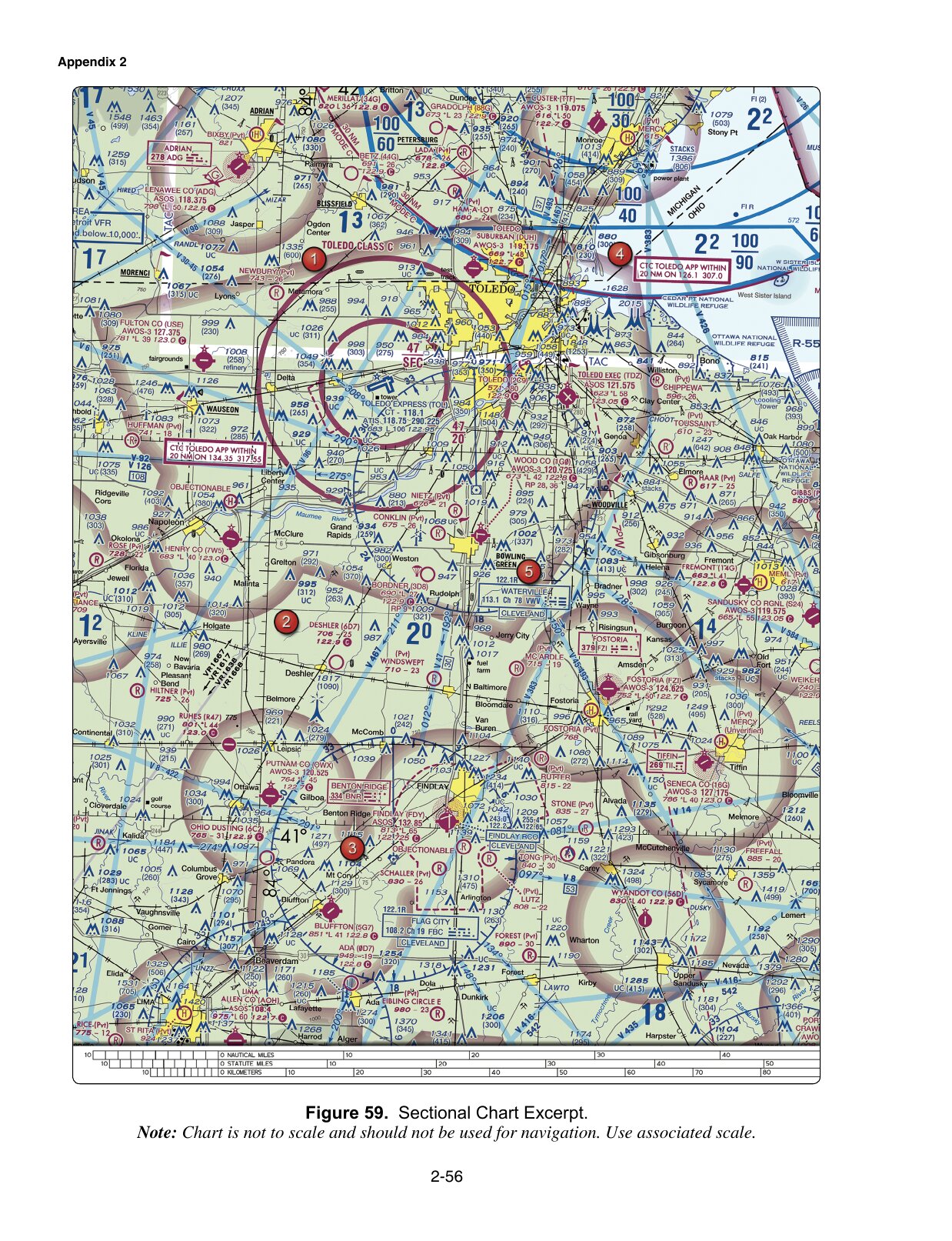
In sample question 2, Class C is stated directly. Monitoring a frequency or contacting ATC after launch does not meet the condition in that rule. The word prior decides the distinction.
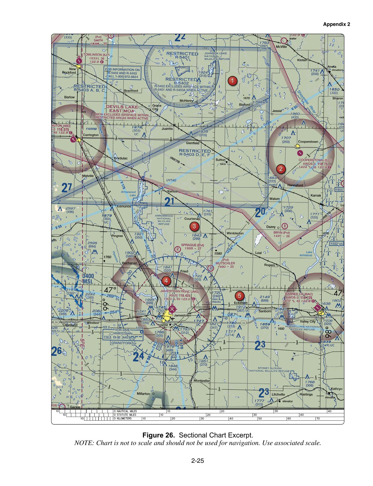
In question 13, the figure supplies the location instead. Find the stated position near Jamestown in the training excerpt, identify the charted surface airspace, then apply the authorization rule. Do not infer the answer merely from the presence or absence of a control-tower frequency.
For an actual operation, use the FAA's current airspace-authorization guidance. These practice images are not current operational charts, and the exercise does not request an authorization for you.
Read the sector and its units together
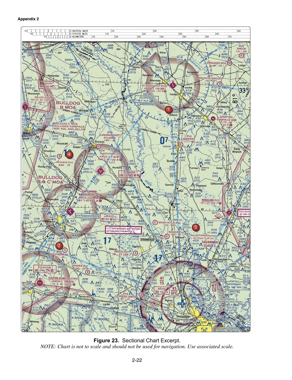
Question 8 asks about the floor of Savannah's Class C shelf in the supplied figure. Locate that shelf before reading its altitude label. In the relevant sector, the lower value is 13, representing 1,300 feet MSL.
The FAA Chart Users' Guide explains the Class C convention: ceiling and floor figures omit the last two zeros and use mean sea level. A number from another sector, or the same number described as AGL, does not answer the question asked.
MSL and AGL use different reference points. Do not substitute the familiar small-UAS height limit for a charted airspace floor. Read the stated unit every time.
A charted military area is not a live activity report
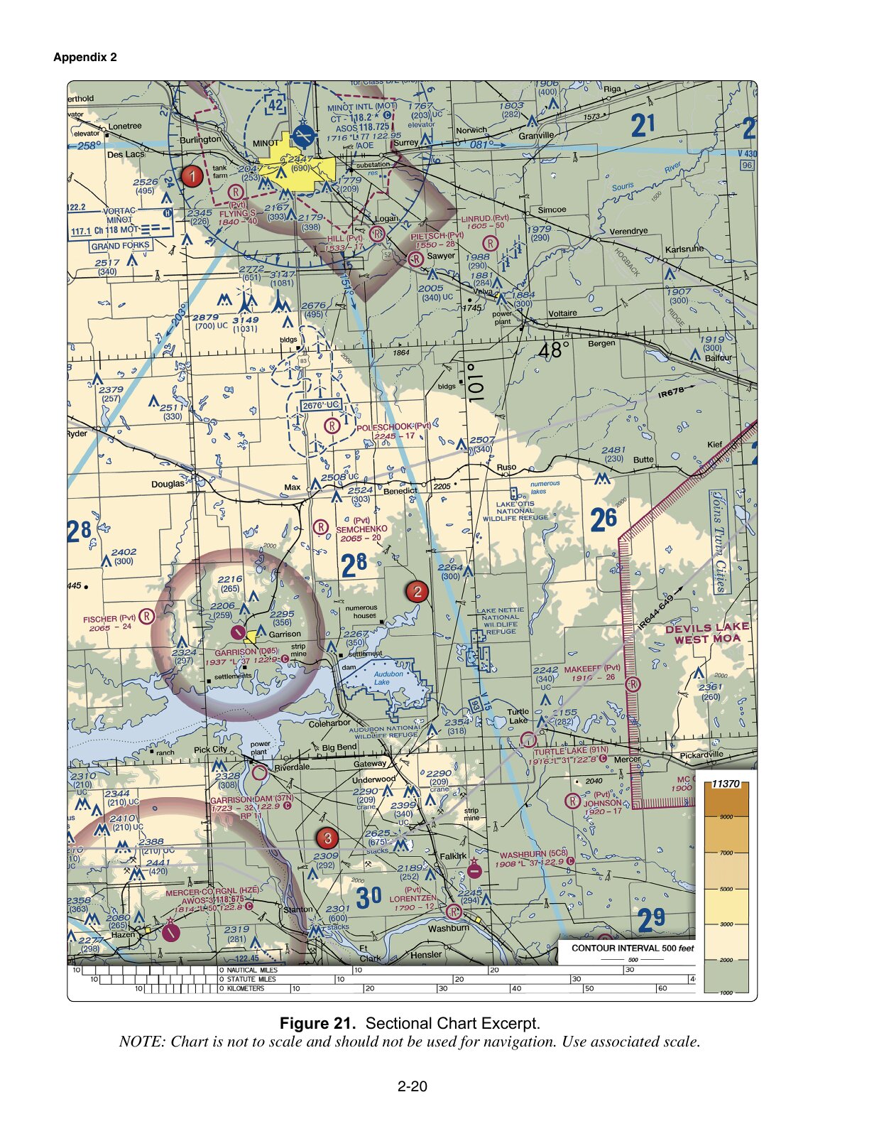
Question 10 points to a military operations area. The chart legend provides published hours, altitudes and a controlling agency, which explains the sample's selected answer. Actual activity can change; the AIM's special-use airspace guidance explains how to obtain current status.
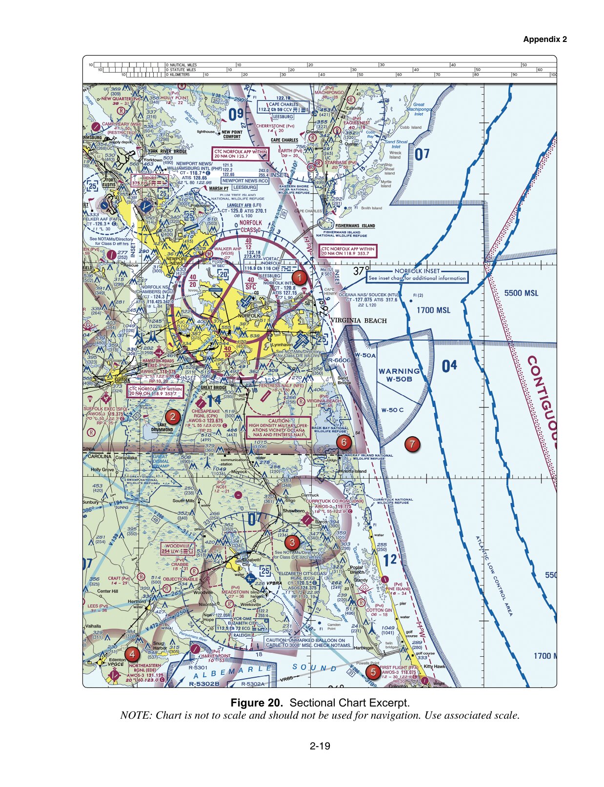
Question 30 asks about a military training route. Its four-digit identifiers indicate a route with no segment above 1,500 feet AGL. That designation does not prove that traffic stays above small-UAS operating heights, nor does it provide separation for your aircraft. See the AIM's MTR explanation.
MOA and MTR are different chart concepts. Learn what each label describes before trying to remember a single response to “military” in a question.
Read the restriction that applies today
Question 14's balloon caution says to check NOTAMs. The sample's online-briefing option points to a current-information source. The old chart image shows why to look; it cannot tell you today's status of that hazard.
Question 46 concerns a sporting-event TFR. A sponsor relationship and a bystander notification do not create permission. 14 CFR 91.145(d) requires compliance with the published authorizations, terms and conditions, unless otherwise authorized through the stated routes. A general waiver is not a pass into every restricted event area.
When reviewing an answer, write the deciding condition beside it: prior authorization, the sector's MSL floor, current activity status, or the specific TFR's conditions. Those distinctions transfer to unfamiliar questions more usefully than a memorized option letter.
If the chart itself is the obstacle, continue with the sectional-chart reading practice. Certbound is not affiliated with the FAA; the published sample questions and Certbound's explanations are labeled separately throughout.